Imagine a tool that predicts traffic patterns before roads are built or simulates flood risks for entire neighborhoods. That’s not science fiction – it’s how modern cities are leveraging geospatial intelligence. Over the last decade, spatial analysis platforms have evolved from basic map-making tools into engines driving smarter infrastructure decisions.
Today’s planners face unprecedented challenges: population growth, climate shifts, and aging public systems. Traditional methods can’t keep pace. We’ve seen how integrating real-time data streams with 3D modeling helps design energy-efficient districts. One project in Phoenix reduced heat island effects by 22% using layered environmental datasets.
The real game-changer? Collaborative platforms that let engineers, policymakers, and residents co-create solutions. During recent flood mitigation planning in Miami, interactive dashboards helped communities visualize trade-offs between seawall heights and park accessibility. This transparency builds trust while accelerating project timelines.
Key Takeaways
- Advanced mapping systems now handle predictive analytics for infrastructure needs
- Integrated data layers improve climate adaptation strategies
- Real-time collaboration tools bridge gaps between planners and citizens
- Spatial analysis reduces costs in long-term maintenance planning
- 3D modeling helps visualize urban development impacts before construction
Introduction to GIS and Urban Planning
Modern cities thrive on precision. At their core lies a digital mapping powerhouse that turns streets, buildings, and ecosystems into layered datasets. This is where geographic information systems redefine how we shape communities.
Understanding GIS in the Context of Urban Development
GIS combines satellite imagery, sensor data, and demographic statistics into interactive maps. Planners use these visual tools to spot patterns invisible to the naked eye. A single map might overlay traffic flow with school locations and pollution levels.
Traditional methods relied on paper charts and guesswork. Now, spatial analysis software calculates flood risks for proposed housing or simulates sunlight patterns for solar-ready neighborhoods. It processes zoning laws, population trends, and infrastructure capacities simultaneously.
Three key applications drive modern planning:
- Land suitability maps identifying growth zones
- 3D models testing building height impacts
- Real-time dashboards tracking resource use
This system doesn’t just display data – it reveals connections. When Austin redesigned its downtown, planners used heat maps to balance green spaces with commercial areas. The result? A 18% increase in walkable amenities without sacrificing density.
The Evolution of Urban Planning With GIS

Urban centers have shifted from static blueprints to dynamic data ecosystems. Early adopters used paper maps and manual surveys. Today’s digital frameworks analyze entire metropolitan systems through layered geospatial insights.
From Pushpins to Predictive Analytics
The 1990s brought digital mapping to planning departments. Satellite imagery integration in 2005 enabled real-time land-use tracking. By 2015, cloud-based platforms allowed multi-agency collaboration on zoning proposals.
Three breakthroughs changed everything:
- GPS-enabled field data collection (2008)
- 3D city modeling software (2012)
- AI-powered traffic pattern prediction (2020)
Today’s Digital Urban Workshop
Machine learning now processes utility usage patterns across neighborhoods. Boston’s planners recently reduced energy waste by 17% using thermal mapping overlays. Real-time sensor networks feed transit updates into decision-making dashboards.
Emerging tools combine augmented reality with demographic data. Chattanooga’s new park designs incorporated crowd-sourced noise level reports. This fusion of physical and digital inputs creates living urban models that adapt as needs evolve.
Why GIS is Integral to Smart City Initiatives

Urban innovation thrives when decisions are rooted in spatial truth. Geographic information systems have become the silent architects behind smarter municipal operations, transforming raw numbers into actionable blueprints for progress.
Data-Driven Decision Making in Urban Environments
Modern municipalities rely on layered data streams to allocate resources effectively. By merging traffic sensors, utility usage records, and population density maps, planners identify priority zones for upgrades. Portland’s bike network expansion showcases this approach – terrain analysis combined with commuter patterns created safer routes without disrupting existing infrastructure.
Singapore’s Smart Nation initiative takes integration further. Their platform processes real-time transit data alongside weather forecasts to reroute buses before congestion forms. This predictive capability reduces commute times by an average of 12% during peak hours.
Real-World Examples from Global Cities
Barcelona’s green space strategy demonstrates GIS applications in environmental planning. Satellite heat maps revealed neighborhoods needing more tree cover, leading to targeted park installations that cooled surface temperatures by 4°F.
Medellín’s equity-focused approach uses spatial analysis differently. Officials overlay school locations with public transport routes to pinpoint underserved areas. Recent upgrades brought 94% of residents within walking distance of educational facilities – a 23% improvement since 2020.
These cases prove that when cities harness geospatial intelligence, they don’t just solve problems – they anticipate them. The result? Communities that adapt faster and serve citizens better.
The Future of Smart Cities: Role of GIS in Urban Planning

Urban landscapes are being rewritten through intelligent mapping systems that optimize every streetlight and subway line. Three core areas demonstrate this transformation: infrastructure resilience, mobility networks, and strategic land allocation.
Powering Smarter Infrastructure and Mobility
Spatial analysis tools now identify weak points in aging bridges before inspections. Atlanta recently used terrain modeling to reroute a $240M sewer project, avoiding unstable bedrock. Transportation planners combine live traffic feeds with event schedules to adjust bus frequencies dynamically.
Key breakthroughs include:
- Utility mapping that overlays pipe ages with soil corrosion data
- Transit algorithms balancing rider demand with energy use
- Zoning models projecting population shifts across decades
Next-Generation Planning Technologies
Machine learning parses satellite images to spot illegal construction in protected zones. Virtual reality models let officials “walk through” proposed skyscrapers while assessing shadow impacts on parks. San Diego’s new coastal plan used 3D flood simulations to preserve beach access during storm scenarios.
Emerging tools solve old problems:
- AI predicts parking demand based on business permits
- Drone surveys update land use maps weekly
- Blockchain secures property boundary records
Leveraging Advanced Technologies in GIS Urban Planning

What if cities could learn from their own data streams to prevent crises before they happen? Cutting-edge technology integrations are making this possible through machine intelligence and interconnected sensor networks. These tools don’t just process information – they anticipate urban needs.
Integrating Machine Learning, AI, and 3D Modeling
Machine learning algorithms now classify land use patterns with 94% accuracy. A Beijing study demonstrated this by predicting urban sprawl three years in advance. When layered with crime statistics, these models identify high-risk zones needing lighting upgrades or patrol routes.
3D modeling takes spatial analysis further. Planners rotate digital replicas of neighborhoods to test sunlight access for new parks. Chicago’s recent high-rise project used this approach to preserve lake views while maximizing housing density.
The Role of IoT in Creating Real-Time Urban Solutions
Connected sensors transform static maps into living systems. Barcelona’s smart trash cans signal collection trucks when full, cutting fuel costs by 19%. Air quality monitors in Denver trigger traffic light adjustments during pollution spikes.
Key IoT integration benefits include:
- Energy grids balancing supply with neighborhood demand
- Flood sensors activating drainage systems before storms hit
- Public transit adapting routes based on live rider data
These systems create feedback loops where cities improve continuously. When combined with predictive algorithms, they form decision-making engines that get smarter with every data point.
Addressing Challenges in GIS-Enabled Urban Growth
What hurdles must cities overcome to fully harness geospatial systems for sustainable development? While GIS transforms urban strategies, its implementation faces technical and operational roadblocks requiring immediate attention.
Data Quality, Security, and Interoperability Issues
Inconsistent data sources undermine planning accuracy. A 2023 study found 38% of municipal datasets contain outdated zoning information. Standardized formats remain elusive – transportation departments often use different coordinate systems than utility providers.
Cybersecurity gaps expose sensitive infrastructure maps. Last year, three U.S. cities faced ransomware attacks targeting sewer system layouts. We recommend encrypted cloud storage and role-based data access to protect critical assets.
Building Capacity and Enhancing Professional Competencies
Only 12% of planning departments have staff trained in spatial analysis tools. Essential skills now include:
- Python scripting for automated data management
- 3D visualization techniques for public presentations
- Cross-departmental collaboration frameworks
Denver’s planning office offers monthly workshops blending technical GIS training with conflict resolution strategies. This dual focus helps teams translate complex maps into actionable community solutions.
Innovative Community Engagement with GIS
What if blueprints could talk? Modern planning teams now use GIS to turn technical proposals into interactive stories. Through layered maps and dynamic dashboards, residents shape neighborhoods they’ll inhabit.
Visual Storytelling and Stakeholder Collaboration
Interactive platforms transform zoning debates into collaborative workshops. Planners display 3D models showing how new parks affect traffic patterns. Citizens mark preferred bike lane routes directly on digital maps.
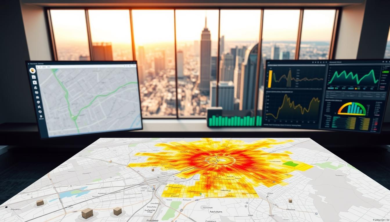
Visual tools bridge knowledge gaps effectively. Heat maps highlight flood-prone areas needing green infrastructure. Color-coded charts compare school access across income brackets. These methods make complex information understandable for all.
We’ve seen success through real-time feedback loops. A coastal city used crowd-sourced maps to prioritize seawall locations. Residents ranked protection needs against beach access – decisions reflected in final plans. This approach cuts revision cycles by 40% in recent projects.
GIS doesn’t just inform communities – it empowers them. When people see how their input reshapes public spaces, trust grows. Spatial tools ensure urban development meets lived needs, not just technical specs.