Did you know over 80% of business decisions rely on location-based insights? Yet fewer than 15% of professionals know how to unlock this data’s full potential. Geographic information systems (GIS) bridge this gap, transforming raw spatial details into actionable strategies that shape industries worldwide.
This technology goes far beyond maps. It weaves layers of environmental, social, and economic data into clear visual stories. From tracking disease outbreaks to optimizing supply chains, organizations use these insights to solve pressing challenges. That’s why experts call it a “Swiss Army knife” for modern problem-solving.
Employers now prioritize candidates who can analyze patterns and communicate solutions spatially. Whether in urban planning or disaster response, professionals with these skills drive innovation. They turn complex datasets into decisions that save time, money, and even lives.
Key Takeaways
- GIS transforms raw location data into strategic insights for diverse industries
- Demand for spatial analysis skills outpaces supply in today’s job market
- Mastering this tool enhances critical thinking and communication abilities
- Career paths span government, tech, healthcare, and environmental sectors
- Technical proficiency pairs with creative problem-solving for maximum impact
Harnessing the Power of GIS in Today’s World
Every pixel on a digital map tells a story, and geographic information systems provide the vocabulary to decode it. These tools don’t just display locations—they layer environmental surveys, traffic patterns, and population statistics into living documents.
Understanding Geographic Information Systems
At their core, these systems combine hardware, software, and spatial data. They overlay flood risk models with property records or crime statistics with street lighting layouts. This stacking approach reveals hidden connections—like how rising sea levels might impact urban infrastructure over decades.
Modern platforms handle more than static images. They create 3D city models that planners can rotate and explore. Time-lapse features track deforestation rates or urban sprawl across years. As one infrastructure analyst noted: “It’s like having X-ray vision for patterns invisible to the naked eye.”
Transforming Data into Impactful Decisions
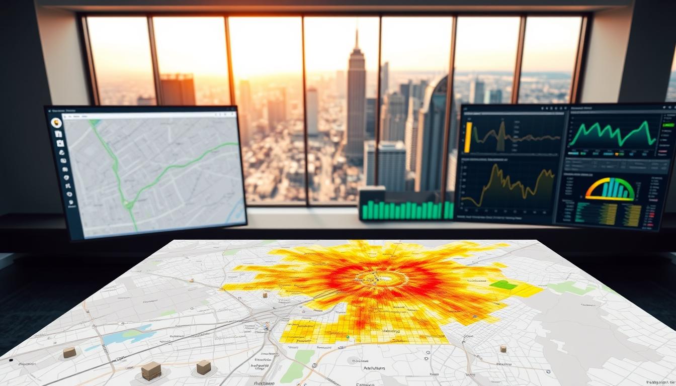
Raw numbers gain meaning when pinned to real-world coordinates. Emergency responders use live traffic updates to choose evacuation routes. Retail chains analyze foot traffic heatmaps to optimize store locations.
Interactive dashboards now let teams manipulate variables on the fly. Adjust a zoning regulation, and instantly see housing capacity projections shift. These dynamic tools democratize complex analyses, putting spatial intelligence in every department’s hands.
10 Real-World Reasons Why GIS Is the Most Powerful Career Tool Today

Interactive maps do more than display locations—they teach professionals to interrogate data. Employers increasingly seek candidates who combine technical expertise with spatial curiosity. This mindset shift creates new opportunities for those fluent in geographic information science.
Boosting Career Prospects Through Spatial Analysis
Job markets reward professionals who ask “where” alongside “why.” Urban planners use traffic pattern overlays to redesign intersections. Epidemiologists map disease clusters to allocate medical resources. These applications demand more than software skills—they require spatial problem-solving tenacity.
A recent infrastructure analyst shared: “Our team solved a decade-old transit issue in three weeks using heatmap analysis. That’s the power employers want.” This approach now drives decisions in unexpected fields like historical preservation and supply chain logistics.
Bridging Technology and Information Science
Modern professionals straddle two worlds. They merge geographic principles with database management and machine learning. This hybrid skillset lets them translate satellite imagery into business strategies or census data into retail expansion plans.
Consider these emerging roles:
- Healthcare accessibility mappers
- Climate risk visualization specialists
- Augmented reality spatial designers
These positions didn’t exist five years ago. As one tech recruiter noted: “We’re not hiring mapmakers—we need spatial storytellers who speak both Python and boardroom.”
Practical Benefits of GIS Across Industries
From logistics to conservation, spatial intelligence reshapes how industries operate daily. Integrated platforms transform raw coordinates into strategic assets, fostering five critical fluencies: problem-solving, data evaluation, teamwork, design thinking, and media analysis. These skills power decisions that cut costs and boost efficiency.
Enhancing Data Collection and Fluency
GIS software streamlines data gathering through unified dashboards. Teams capture field measurements, satellite feeds, and sensor inputs in real time. One logistics manager noted: “We reduced shipment errors by 40% after implementing mobile mapping tools.”
This approach nurtures solution fluency—blending creativity with technical rigor. Professionals learn to spot patterns in traffic flows or energy usage that others miss. They cross-check sources rigorously, ensuring decisions rest on verified geographic information.
Integrating GIS Software for Efficient Mapping
Modern platforms automate tedious tasks like zoning calculations or parcel delineation. Key advantages include:
- Automated route optimization for delivery networks
- 3D modeling for construction site planning
- Real-time inventory tracking via geofencing
Retailers use heatmaps to compare foot traffic against sales data. Utilities map outage risks using weather patterns and infrastructure age. Each application shares a common thread: turning coordinates into actionable insights.
Leveraging Geographic Information for Informed Decisions
Environmental teams track mineral deposits with precision unseen in traditional surveys. Compare methods:
| Factor | Traditional Surveys | GIS-Enhanced Tracking |
|---|---|---|
| Data Accuracy | ±15% margin | ±2% margin |
| Update Frequency | Quarterly | Daily |
| Analysis Time | 3 weeks | 48 hours |
| Cost Efficiency | $12/acre | $4/acre |
This table shows how geographic information systems overhaul resource management. Teams collaborate across time zones, updating shared maps that guide drilling permits or conservation efforts. Spatial storytelling makes complex data accessible to non-technical stakeholders.
Innovative Applications in Transportation and Infrastructure

Urban centers face growing challenges as populations expand—congested roads, inefficient transit, and strained infrastructure. Spatial intelligence tools provide a way forward, transforming how cities design and manage transportation networks.
Optimizing Urban Planning and Traffic Management
GIS solutions help planners visualize elevation changes and drainage patterns before breaking ground. One city engineer noted: “We redesigned a flood-prone intersection using 3D terrain models, preventing $2M in potential damage annually.”
Transportation departments now rely on real-time traffic flow maps to adjust signal timings. Compare traditional methods with modern approaches:
| Metric | Manual Planning | GIS-Enhanced Systems |
|---|---|---|
| Route Analysis Time | 14 days | 3 hours |
| Cost Overruns | 22% average | 6% average |
| Public Feedback | Paper surveys | Interactive web maps |
Logistics companies achieve 18% faster deliveries using geospatial tracking. Key applications include:
- Dynamic rerouting around accidents or weather
- Fleet maintenance alerts based on road conditions
- Delivery density heatmaps for warehouse placement
Public transit agencies use ridership pattern maps to extend popular routes. These systems also help balance new construction with green space preservation—a critical concern in fast-growing cities.
Enhancing Community Connections and Mobile Workforce Integration

Grassroots projects gain momentum when mapped data reveals hidden community needs. Modern tools turn neighborhood observations into structured plans, creating bridges between residents and decision-makers.
Engaging Local Issues with Real-Time GIS Data
Schools now use field-ready apps to tackle hyperlocal challenges. A high school class in Buffalo mapped pothole locations using ArcGIS Survey123, prompting faster repairs. Community gardens flourish when teams layer soil quality data with sunlight patterns.
Three ways spatial tools drive civic action:
- Visualizing traffic accident hotspots to justify safety upgrades
- Tracking graffiti removal progress across city districts
- Designing accessible bike trails using elevation models
One urban planner noted: “Residents trust proposals more when they see their own survey responses on the map.”
Empowering Field Operations and Mobile Workforces
Mobile teams now complete field work 60% faster using real-time data syncs. The Data Citizens initiative trained students to document storm drains while learning infrastructure basics. Their findings helped municipalities prioritize flood prevention upgrades.
Key tools transforming outdoor projects:
- ArcGIS Field Maps for asset inspections
- Citizen science apps crowdsourcing environmental data
- Cloud-based dashboards updating team members instantly
Educational programs blend classroom theory with hands-on GIS projects. This approach builds technical skills while fostering civic responsibility—proving technology serves people best when rooted in local contexts.
Conclusion
Spatial intelligence reshapes how we address planetary challenges while creating equitable career paths. Those mastering these tools don’t just analyze maps—they bridge technical expertise with environmental stewardship and social impact.
Through geographic information science, professionals gain confidence to tackle climate resilience and resource management. Organizations now seek thinkers who transform coordinates into sustainable solutions. This shift opens doors for underrepresented groups in tech, proving spatial skills transcend traditional industry boundaries.
Our world demands decision-makers fluent in both data and real-world context. As cities adapt and companies prioritize green strategies, these abilities become career accelerators. The next decade will reward those who visualize problems through geographic lenses while driving measurable change.
Mastering spatial analysis today positions professionals at humanity’s critical crossroads. It’s not just about mapping landscapes—it’s about charting futures where technology serves communities and ecosystems equally.